Footpath to Freeway: The Evolution of Michigan Road Maps
This exhibit traces how roads have been depicted on Michigan maps from the time it was a territory to the present. In addition to maps, it includes photographs, unique short-lived route guides and artifacts. Maps evolved in step with the road system and showed advances such as named roads which were in time replaced with numbered state and federal routes. Publishers include map giants Rand McNally and Gousha who also supplied oil companies with their ubiquitous freely distributed roadmaps.
Part 2: State of Michigan - 19th Century
Click on thumbnail image to view larger image.
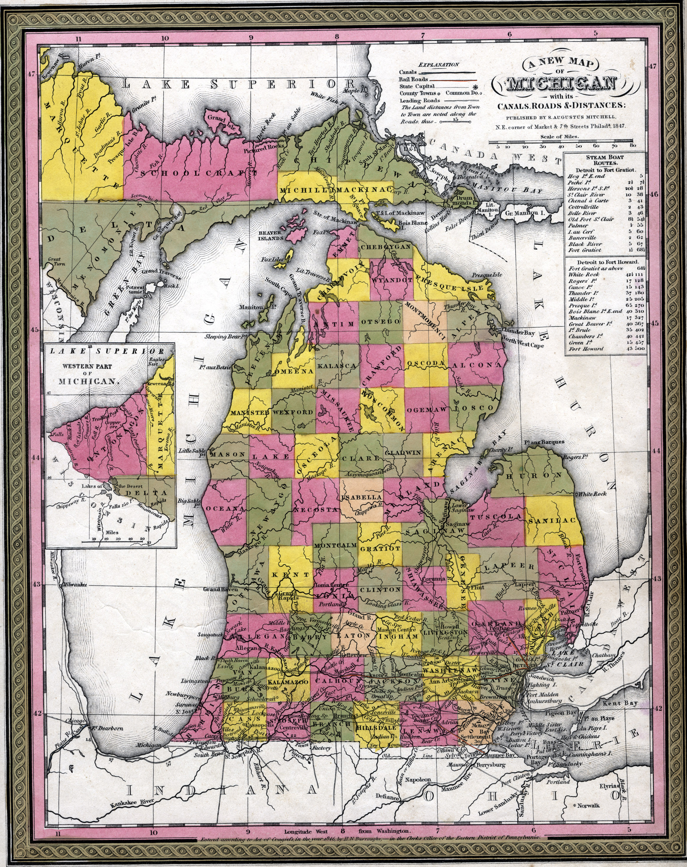
- A new map of Michigan with its canals, roads & distances
- Maps issued shortly after statehood, such as this Mitchell map of 1846, continued to reflect the expanding road network in southern Lower Michigan, along with proposed railways and canals. The burden of construction and improvement of roads fell upon the local governments, so relatively little attention was paid to long distance roads between cities. Travel by stage was still quite common during this early period, but roads were in a wretched condition and travel over them was a hazardous venture as well as rigorous endurance test for those involved.
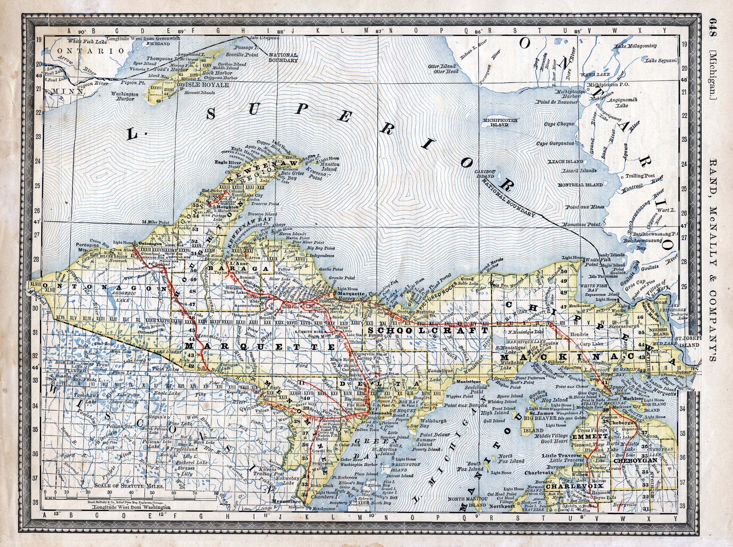
- "Michigan." In Rand McNally & Co.'s Indexed atlas of the world, containing large scale maps of every country and civil division upon the face of the globe, together with historical, statistical and descriptive matter relative to each ...
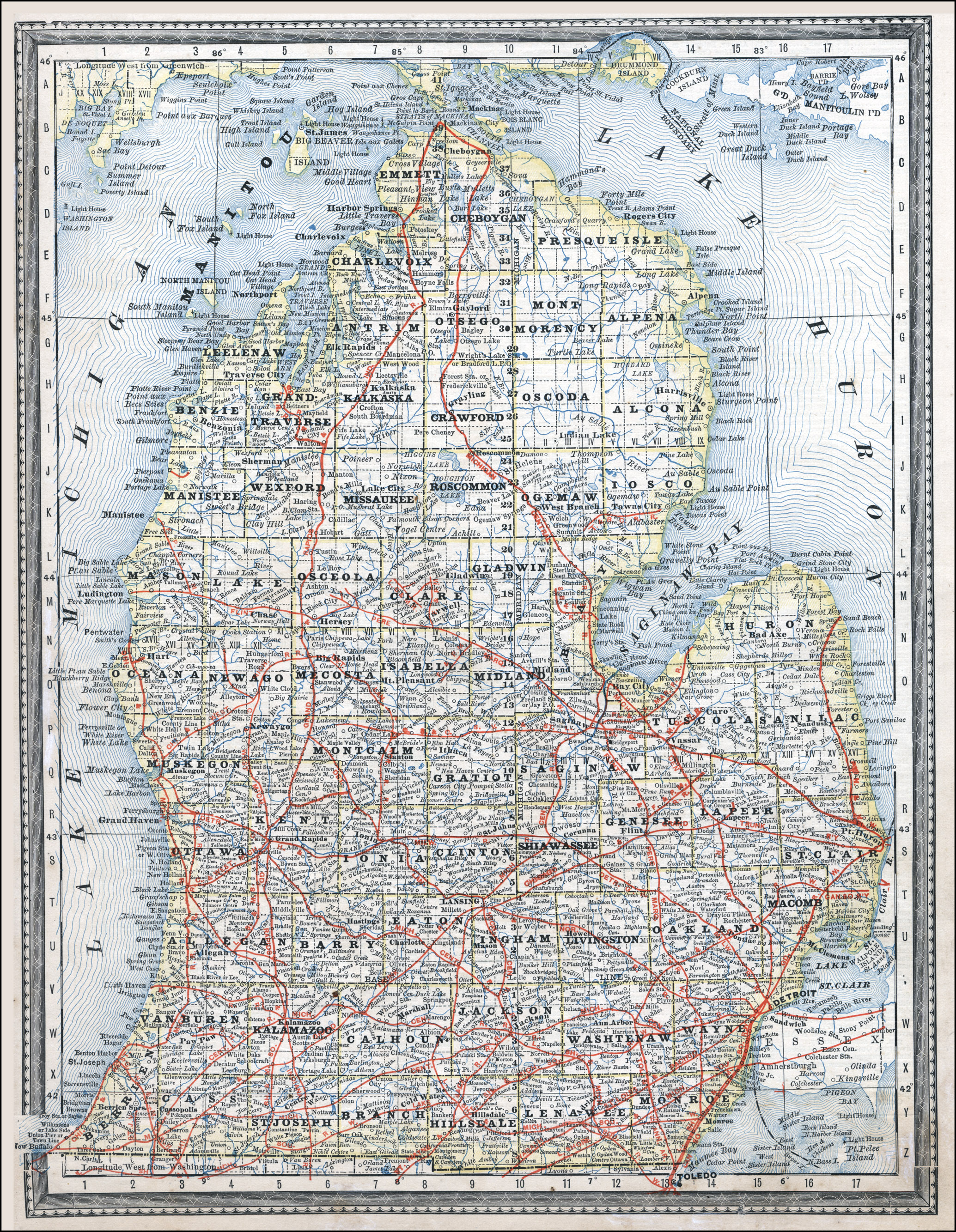
- With the emergence and then expansion of the railroad in the middle of the 19th century, the use of roads for long distance travel in Michigan was greatly diminished. Travel by horse, buggy, and wagon was generally limited to the local area and road conditions between cities gradually deteriorated. Not surprisingly, maps of this period focused on the rail lines with scant, if any, attention given to the roads. Most cartography in the mid-to-late 19th century, such as the Rand mcNally 1881 map portrayed here, was exclusively geopolitical showing important natural resources and political boundaries. Maps, even detailed ones, barely acknowledged the road system at all, choosing to favor the train routes.
- Woodward Avenue, Detroit
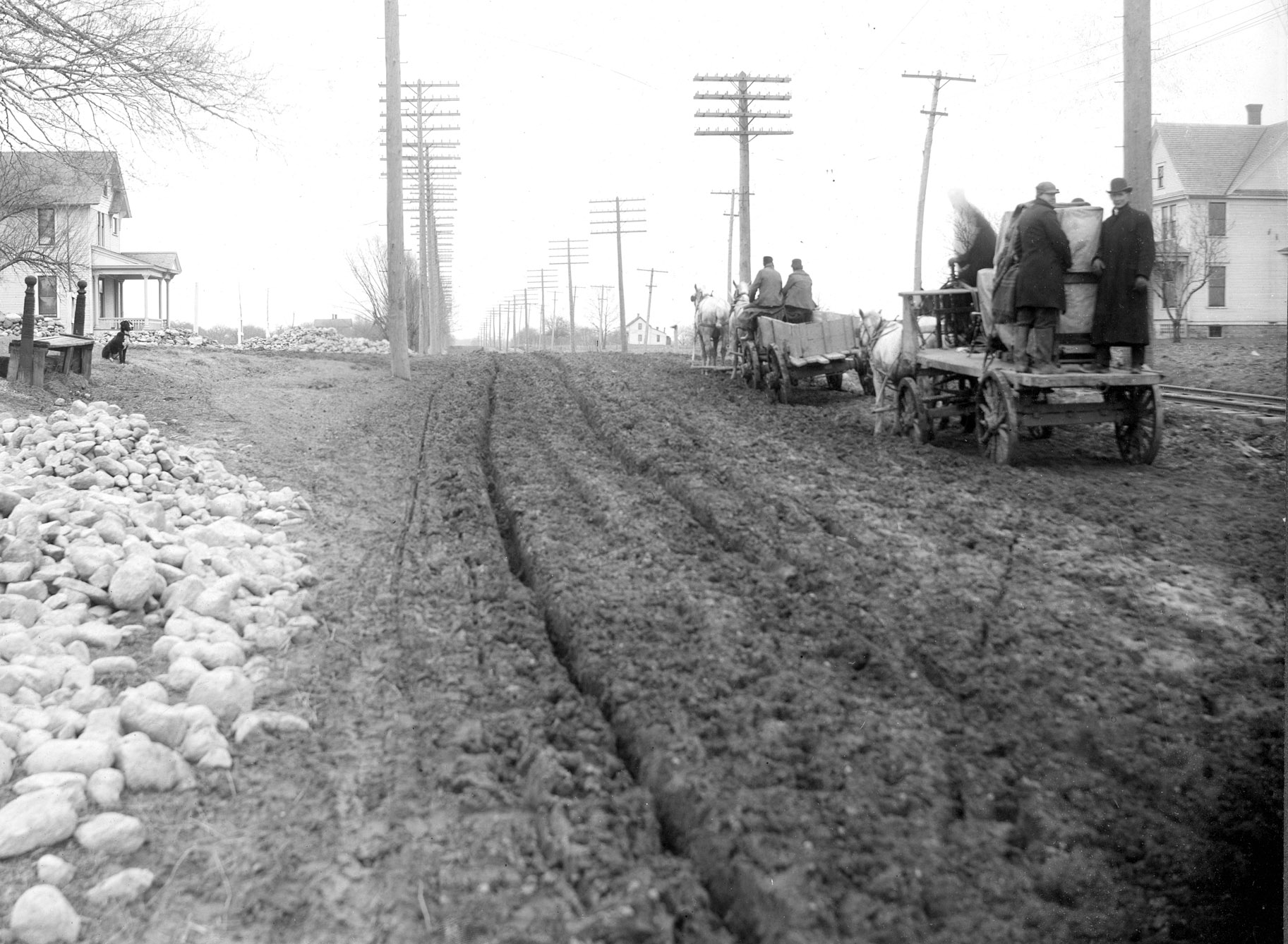
- Early vehicles had to struggle with poorly maintained roads.
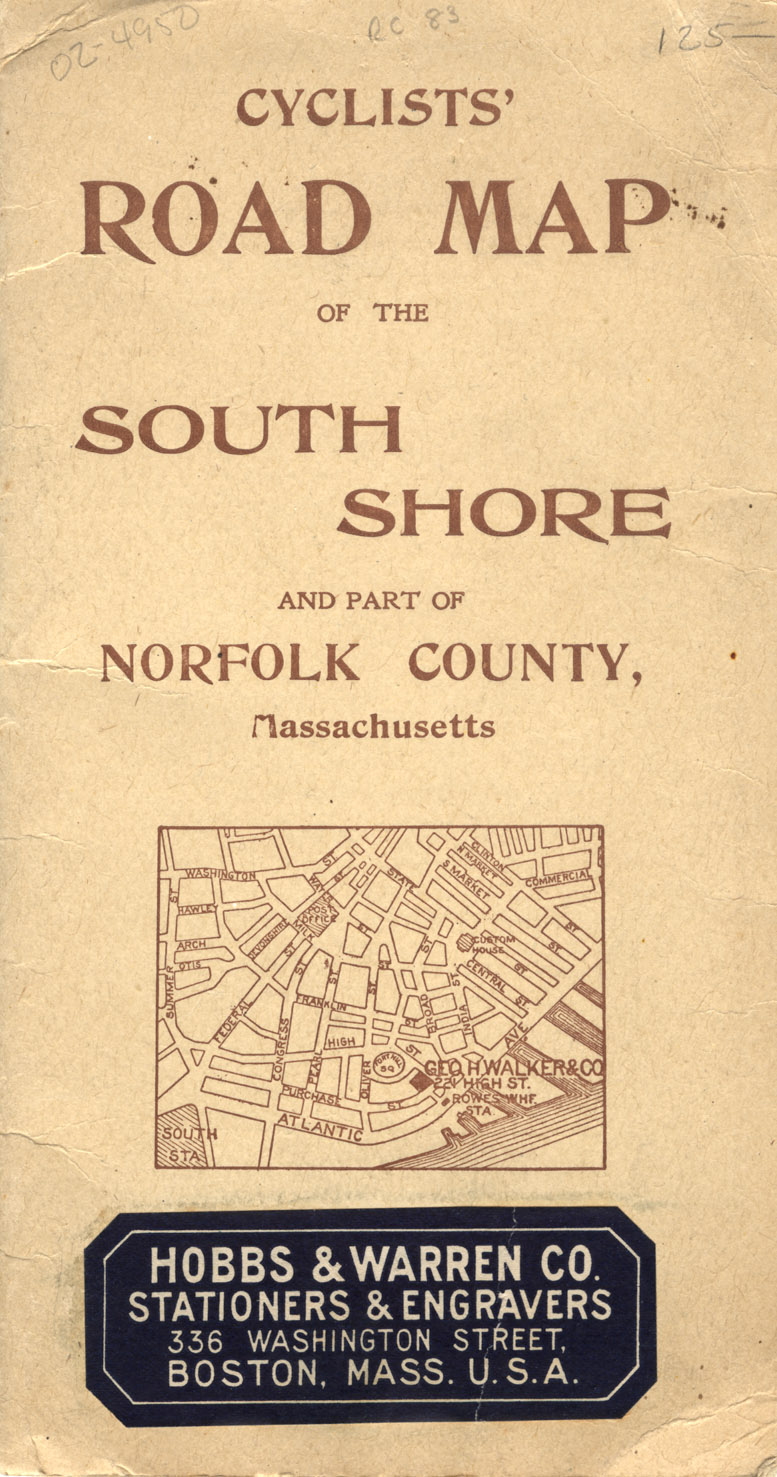
- Cyclists’ road map of the south shore and part of Norfolk County, Massachusetts
- During the 1890’s the bicycle emerged as a popular mode of travel. It stimulated an interest in road travel, road improvements and road maps. The League of American Wheelmen lobbied for improved roads and produced books and maps describing road conditions. These maps included topography and water features, important elements for cyclists. Later road maps that focused on the interests of automobile drivers tended to de-emphasize these features.