
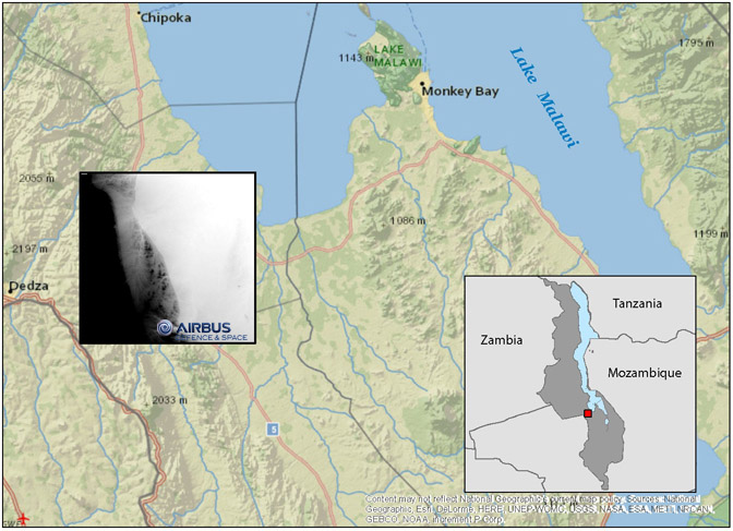
Malawi Digital Elevation Model (Dedza Area Only)
Title: Malawi Digital Elevation Model (Dedza Area only)
Originator: Airbus Defence and Space and Deutsches Zentrum für Luft- und Raumfahrt
Publication Place:
Publisher: Airbus Defence and Space and Deutsches Zentrum für Luft- und Raumfahrt
Beginning Date: 2014
Ending Date:
Extent: 1 tile
Pixel Value: 12-meter
Coordinate System: WGS84
Format: Available for download in TIF
Bounding Coordinate West: 34.433
Bounding Coordinate East: 34.680
Bounding Coordinate North: -14.218
Bounding Coordinate South: -14.457
Notes: The downloadable file covers an area of 702.25 square kilometers extracted from WorldDEM. WorldDEM™ is the product of the TanDEM-X Mission (TerraSAR-X add-on for Digital Elevation Measurements), realized as a Public Private Partnership (PPP) between Airbus Defence and Space and the German Aerospace Centre (DLR).
Access Restriction: This resource has been licensed for use by the MSU community. For off-campus access, users must have a MSU NetID and password. Our contract with the vendor restricts off-campus access to currently enrolled MSU students and current employees. MSU Alumni are not included in these groups. Visitors to the main library may also access this resource at one of our Selected Resources computers. If your NetID and password are not working to get you into this site, please see this Guide to Off-Campus Access.
Contact Information:
Kathleen Weessies
Map Library
MSU Libraries, Room W308
366 W. Circle Drive
East Lansing, MI 48824 USA
(517) 884-0849
E-mail:weessies2@lib.msu.edu
URL: http://lib.msu.edu/map/
Malawi DEM Listing
| Name | ZIP |
|---|---|
| Dedza Area | Dedza Area.zip |