
Cuba Vector Data (National)
More Vector Files (Contours and Stream Polygons) available on our Cuba Vector (Tiles) Finding Aid
Title: Cuba Vector Data (nationwide)
Originator: LandInfo Worldwide Mapping LLC
Publication Place: Littleton, Colorado
Publisher: LandInfo Worldwide Mapping LLC
Beginning Date:
Acquisition Date: 2016
Extent: x data types
Scale: 1:100,000
Projection: WGS84
Format: Available for download in zipped shapefile bundles
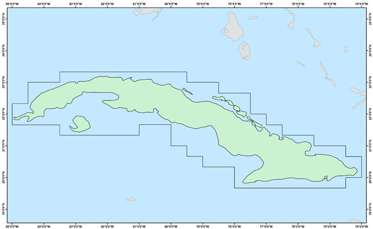
Bounding Coordinate West: -80.17
Bounding Coordinate East: -73.95
Bounding Coordinate North: 23.38
Bounding Coordinate South: 19.65
Notes: Layers include lines and polygons. See below for list of features. Vectors were derived by LandInfo from Soviet 1:100,000 topographic maps. Tiles were merged by MSU Libraries.
Access Restriction: This resource has been licensed for use by the MSU community. For off-campus access, users must have a MSU NetID and password. Our contract with the vendor restricts off-campus access to currently enrolled MSU students and current employees. MSU Alumni are not included in these groups. Visitors to the main library may also access this resource at one of our Selected Resources computers. If your NetID and password are not working to get you into this site, please see this Guide to Off-Campus Access.
Contact Information:
Kathleen Weessies
Map Library
MSU Libraries, Room W308
366 W. Circle Drive
East Lansing, MI 48824 USA
(517) 884-0849
E-mail:weessie2@lib.msu.edu
URL: http://lib.msu.edu/map/
Geographic Extent of Data
List of Layers
| Feature | Link |
|---|---|
| Built Up Areas | bltareas.zip |
| Dirt Roads | Roaddirt.zip |
| Highways | Roadhigh.zip |
| Lakes | Lakes.zip |
| Paved Roads | Roadpave.zip |
| Railroads | Railsingle.zip |
| Streams | streams.zip |
| Unpaved Roads | Roadunpav.zip |