

close
Provide feedback on this item
Please provide details, labels, or ideas that will help this image be more findable and better described.

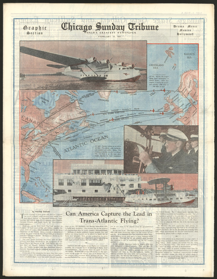
Can America capture the lead in trans-Atlantic flying? : map of the Atlantic Ocean
A map of the eastern U.S. and western Europe, including islands in the Barents Sea (sic). The map shows the proposed routes from New York and Chicago via steamship and plane.
1935-02-24
35 x 38.5 cm
Tribune Company
color
- English
- still image
- text
- These materials are either in the public domain, according to U.S. copyright law, or permission has been obtained from rights owners. The digital version and supplementary materials are available for all educational uses worldwide.
- The Janet A. Ginsburg Chicago Tribune Image Collection
- Chicago Sunday Tribune (February 24, 1935), Graphic Section/Drama/Music/Movies/Hollywood, p. 1
- application/pdf
- image/jpeg

- Home
- About
- Full Text Search
- Browse
- Contact Info