

close
Provide feedback on this item
Please provide details, labels, or ideas that will help this image be more findable and better described.

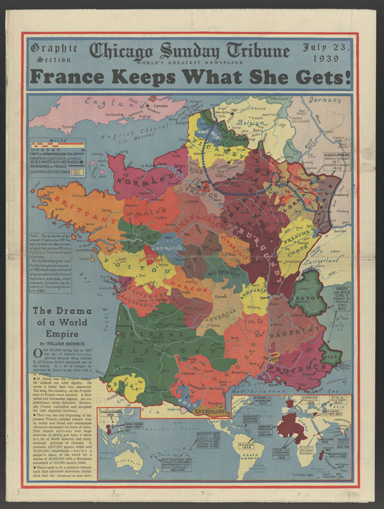
France keeps what she gets!
This map of France shows political boundaries during 1939, including the line to which German forces advanced during World War I. Includes an inset map of the world showing French land and acquisition dates. The map was published several months before the start of World War II.
1939-07-23
49.6 x 36.7 cm
Tribune Company
color
- English
- still image
- text
- These materials are either in the public domain, according to U.S. copyright law, or permission has been obtained from rights owners. The digital version and supplementary materials are available for all educational uses worldwide.
- The Janet A. Ginsburg Chicago Tribune Image Collection
- Chicago Sunday Tribune (July 23, 1939), Graphic Section, p. 1
- application/pdf
- image/jpeg

- Home
- About
- Full Text Search
- Browse
- Contact Info